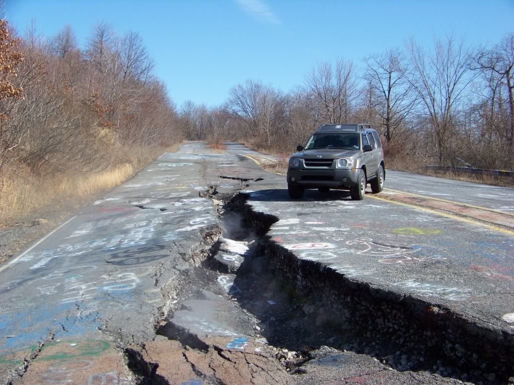
Here's another pix taken Near Centralia PA today (3/1/11). This one is on what used to be Route 61. This section of the road was shut down in the early 80's due to the fire causing it to sink in places, at first they tried just putting new blacktop down on top of the old to get rid of the dips in the road, but it kept sinking a few weeks later. At one time when driving on this section at night, you could look at the bank on the side of the road, where they tried to backfill it with stone, and it was like looking into a coal stove the way the stone was glowing so bright. This section of road is about a half mile south of the town of Centralia. If you look close at the pix you can see smoke/steam coming out from the crack in the road. The one thing this pix doesnt do justice , is how far the road sank here, if you look from the X to the side of the road, the shoulder of the road has actually sunk about 3 feet there, which is what caused the crack. It took about 8 months for the crack to get that big from the time it started to crack. Over the last few years, it doesnt look like it got much bigger.
Also, for anyone who uses Google Earth, you can actually get a better idea of the size of this crack in the road by zooming in on it on Google Earth. Just go to Centralia PA and follow RT. 61 South . There are also some pix on there from other ppl of that area.
No, you wont see my X in the image from Google Earth though !!


 Previous Topic
 Index
Index
